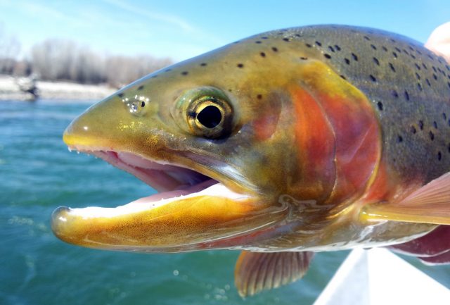
Ohio – ODNR will release just over 83,000 rainbow trout will be released this spring at 66 Ohio public lakes and ponds starting in a few weeks.
Every year ODNR releases State raised fish from Ohio owned hatcheries into public lakes and ponds for opportunities for families to fish together. The hatchery fish measure around 10-13 inches before they are released by the ODNR Division of Wildlife.
“By stocking these water areas throughout the state, opportunities are created for anglers of all ages to get out and enjoy quality spring rainbow trout fishing in a family-friendly environment. Many stocked locations will feature special angler events, including youth-only fishing on the day of the trout release. The daily catch limit for inland lakes is five trout per angler,” said ODNR.
Rainbow trout releases will take place across Ohio from March 13 – May 17 as long as areas are ice-free and accessible to anglers.
Areas being stocked this year in the Southern area of Ohio are as followed
Adams Lake (West Union): From West Union, follow SR 41 east/north 1.5 miles to the Adams Lake State Park entrance on the left.
Davis Lake – 15500 Saint Marys River Road: From US 33 and SR 66 in St. Marys, head north on SR 66 for two miles. Turn left onto Glynwood Road. Follow Glynwood Road. for two miles, then turn left onto St. Marys River Road. The entrance to the lake will be .5 mile on the left.
Clark Lake (Springfield): From the Springfield area, take I-70 east to the US 40 exit. Follow US 40 east for just 0.1 mile, and turn left (north) on Bowman Road. Follow Bowman Road about 1.2 miles to Old Columbus Road. Turn right (east), and follow Old Columbus Road one mile to Vernon Asbury Road. Turn left (north) on Vernon Asbury Road, and the entrance to Clark Lake is ahead on the right
Rocky Fork Lake (Hillsboro): From Hillsboro, follow SR 124 south about four miles. Turn left (east) on North Shore Road. Follow North Shore Road about one mile to the Rocky Fork State Park campground entrance. The children’s fishing event is located at the campground marina boat basin.
Rush Run Lake (Germantown): From Germantown, follow SR 725 west to Gratis. Continue west on SR 725 another 3.7 miles to Wayne Trace Road. Turn left (south), and follow Wayne Trace Road 3.5 miles to Northern Road. Turn right (west), and follow Northern Road one mile to Pogue Frazee Road. Turn right (north), and follow Pogue Frazee Road about 0.7 miles to the main parking lot for Rush Run Lake.
Stonelick Lake (Milford): From Milford, follow SR 131 east about 8.5 miles to SR 727. Follow SR 727 east about three miles to the main entrance for Stonelick State Park.
Sycamore State Park Lake (Dayton): From Trotwood, take Wolf Creek Pike west about 2.8 miles to Diamond Mill Road. Turn right (north), and follow Diamond Mill Road about 0.5 mile to Providence Road. Turn left (west), follow Providence Road about 0.5 mile, and turn left into the entrance for the Overlook Picnic Area.
Tawawa Lake (Sidney): From I-75 and SR 29 interchange, take SR 29 east about 2.2 miles to downtown Sidney. Follow SR 29 east across the Great Miami River. Turn left onto SR 47 East/North. Follow SR 47 one half mile, and turn right onto Tawawa Drive at Tawawa Park.
Barnesville City Reservoir # 3 – Slope Creek Reservoir (Barnesville): Take SR 800 south from Barnesville, turn right (south/west) on Township Rd 514 to boat ramp.
Belmont Lake – Barkcamp State Park (St. Clairsville): Depart St Clairsville, Ohio using Interstate 70 (west). Using Exit 208, turn left (south) onto SR 149. Turn left (east) onto SR 147, then left (north) onto SR 147 (SR149). Bear left (east) onto SR 149. Turn left (North) onto Township Road 208 (Plainfield Road). Bear right (northeast) onto ODNR Local Road.
Blue Rock State Park – Cutler Lake (Zanesville): Depart Zaneville, Ohio using SR 60. Turn left (east) onto Shaver Road. Turn left (north) onto Poverty Ridge Road. Turn right (north) on ODNR Local Road.
Dow Lake – Stroud’s Run State Park (Athens): Depart Athens, Ohio on E. State Street off US 33. Turn right (north) onto Madison Avenue. Turn right (northeast) onto Columbia Avenue. Road name changes to County Road (CR) 20 (Stroud’s Run Road). Turn right to stay on CR 20. Turn right to continue on CR 20. Turn onto ODNR Local Road.
Forked Run State Park (Tuppers Plains): Depart Tuppers Plains, Ohio on SR 7. Turn left (east) onto SR 681. Turn right (south) onto SR 124. Turn right (north) onto ODNR Local Road.
Jackson City Reservoir – Hammertown Lake (Jackson): Depart Jackson, Ohio on East Main Street. Turn left on Broadway Street. Continue on E. South Street. Continue on W. South Street. W. South Street becomes Jisco West Road. Turn right on Hammertown Lake Road.
Lake Alma State Park (Wellston): Depart downtown Wellston, Ohio using SR 93 (N. Pennsylvania Avenue). Turn right (east) onto SR 349. Turn right (east) onto Lake Alma State Park ODNR Local Road.
Monroe Lake Wildlife Area (Woodsfield): Depart Woodsfield, Ohio on SR 800 (north). Turn left (west) on ODNR Local Road. Arrive Monroe Lake Wildlife Area camping/dam access.
-OR- Turn left (west) on County Road 2 after 3.9 miles on SR 800 (north). Turn right (north) on SR 145 to Miltonsburg. Turn right (east) on Township Road 1001 to boat ramp/shoreline access.
New Lexington City Reservoir (New Lexington): Depart New Lexington, on SR 13 (north), turn left (west) on SR 37 and SR 13, turn right (north) on SR 13, turn right (northeast) on Perry County Road 19, arrive at New Lexington Reservoir “ramp.”
Rose Lake (Hocking Hills State Park): Depart from US 33 and SR 664 intersection (southwest) on SR 664 from Logan, Ohio. Arrive at Hocking Hills State Park Lodge HDQ (internal roads).
Turkey Creek Lake – Shawnee State Park (Portsmouth): Depart Portsmouth, Ohio West onto US 52. Turn right (northwest) onto SR 125. Turn left (west) onto ODNR Local Road to boat ramp or shore access.
Timbre Ridge Lake – Wayne National Forest (Ironton): Depart US 52, Ironton, Ohio at U.S. 52 (west). At exit SR 141, keep right onto ramp. Turn right (northeast) onto SR 141 (Campbell Drive). Bear right (north) onto SR 141. Turn left to stay on SR 141. Keep left onto SR 775 and follow Palestine Church-Yarico Road. Turn right (south) onto Timber Ridge Rec. Road 91.
Vesuvius Lake (Ironton): Depart Ironton, Ohio from US 52 and SR 93 intersection, keep straight onto SR 93 (northeast) then turn right (east) on Lawrence County Road 29 (Ellisonville-Paddle Creek Road). Turn left (north) on Lawrence County Road 20 (Loop Road) and then turn right (east) into Vesuvius Lake boat ramp area.
Wolf Run State Park (Belle Valley): Depart Belle Valley, Ohio at State Route 821 exit off Interstate 77. Go Southeast on SR 821. Turn left (northeast) on SR 215 . Turn left (northwest) on Park Drive (or other ODNR Local Roads).
Yoctangee Park Lake – Chillicothe Park District (Chillicothe): Depart from SR 104 @ US 35, Chillicothe, Ohio. Continue on N High St. Turn left on W Main St. Turn left on N Mulberry St.
Antrim Park Lake (Columbus): From SR 315 and Bethel Road in Columbus go west on Bethel Road to Olentangy River Road. Turn right on Olentangy River Road. Turn right into Antrim Park at flashing yellow light.
Ashley upground (Ashley): from SR 229 and SR 42 head east on SR 229. The reservoir will be less than one mile down the road on the right. The entrance to the park will be the first right after passing Ashley Road (CR 243).
Blue Limestone Park Pond (Delaware): From SR 23 and Central Avenue proceed west on Central Avenue. Turn left on Elizabeth Street. Turn right on John Street. This is the entrance to Blue Limestone Park.
Cenci Park Pond (Lancaster): From SR 33 in downtown Lancaster go south on SR 33. Exit on Broad Street (also listed as SR 793). Turn right on Broad Street. Entrance to Cenci Park is just beyond overpass.
Eyman Park Ponds (Washington Court House): From I-71 and SR 41 go south on SR 41 to Washington Court House. Turn right on Eyman Park Drive. Youth-only fishing until 2:00 pm on day of stocking.
Foundation Park Pond (Mt. Vernon): From SR 229 and SR 36 go north on Columbus Street. Turn left at Norton Street. Proceed north on Norton Street until it dead-ends in Foundation Park. The first pond on the left is stocked with rainbow trout.
Heritage Park Pond (Groveport): From I-270 and Alum Creek exit go south on Alum Creek Drive. Turn left (east) on Groveport Road to College Street in Groveport. Turn right onto College Street. College Street ends on Wirt/Rohr Road. Turn right and enter Heritage Park at gate on left. (Groveport fishing regulations – catch and release only for all species other than rainbow trout for anglers 16 years and older).
Mt. Gilead State Park Lake (Mt. Gilead): From downtown Mt. Gilead take SR 95 east to the edge of town. Park is on left. Rainbow trout are stocked in the larger pond.
Quarry Park Pond (Marion): From SR 23 and Marion-Williamsport Road go west on Marion-Williamsport Road to Hillman-Ford Road. Turn left, Quarry Park is on left.
Sunbury upground (Sunbury): from I-71 and SR 36/37 head east on SR 36/37 for approximately three miles. Continue straight (east) on Cherry Street and then turn left (north) on Otis Street. Otis Street. will dead end at the upground reservoirs. Rainbow trout will be stocked in the reservoir on the right (east).


